Posts

Showing posts with the label surveying

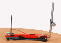
ndian pattern tangent clinometer
Image
Indian pattern tangent clinometer  is used for determining differnce in elevation between two points and is specially adopted to a plane tabling. The clinometer is placed on table which is levelled by estimation. Clinometer consists of following parts: 1.A base plate 2.The eye vane 3.The object vane

Raft foundation

RAFT FOUNDATION IS A  thick concrete slab resting on a large area of soil/surface reinforced with steel, supporting column or wall and transfer its  loads from the structure to  soil. it is generally used to support structures like residential or commercial buildings, hostel/schools  where soil condition is poor, storage tanks, silos, foundations for heavy industrial equipment etc. it is very important type of foundation in modern ways of construction.

what is Prismatic compass ?

Image
Compass surveying is a branch of surveying in which directions of surveying lines are determined with a compass and the length of lines are measured with a tape or chain. In practice the compass is  generally used to run a traverse. In surveying, "Traverse" consists of a series of straight lines connected together to form a open or a closed polygon. Methods of traversing: Depending on the type of instrument used for the measurement of angles the method of Traversing can be classified as under; 1.Chain Traverse 2.Compass Traverse. 3.Plane Table Traverse. 4.Stadia Traverse. 5.Theodolite Traverse. IN Compass Traverse the direction of the traverse lines are determined with a magnetic compass. The magnetic Compass may be "SURVEYOR COMPASS" OR "PRISMATIC COMPASS" PRISMATIC COMPASS: The prismatic compass is one of the magnetic compass in which there is a prism for taking observations. The prismatic compass is generally smaller in size than a surveyor  compass. T...

what is contouring?

Image
A contour is defined as an imaginary line of constant elevation on the ground surface. It can also be defined as the line of intersection of a level surface with the ground surface. For example, the line of intersection of the water surface of a still lake or pond with the surrounding ground represents a contour line.                                                                                                   It facilitates depiction of the relief of terrain in a two dimensional plan or map. The process of tracing contour lines on the surface of earth is called contouring. A contour map gives the idea of the altitudes of the surface features as well as their relative positions in a plan CONTOURING BY INDIRECT METHOD: The points surveyed...

plane table survey................

Image
Plane table is a graphical method of surveying in which the field works and the plotting is done simultaneously. It is particularly adopting in small mapping. Plane table surveying is used for locating the field computation of area of field. Merits: It is most suitable for preparing small scale map or surveying small area. It is most rapid method. Field book is not necessary. No great skill is required for satisfactory map. It is particularly suitable for magnetic area where prismatic compass is not reliable. Contour and irregular object may be represented accurately. It is less costly. Demerits: Plane Table Essentially a tropical instruments. It is not suitable to work in wet climate. There are several accessories to be carried out and therefore they are likely to be lost. It is not suitable for accurate work. Parts of plane Table: Plane table essentially consist of Drawing board mounted on tripod. Alidade.

Gunter's chain......

it is a measuring device used for land survey. Gunter divided the chain into 100 links, marked off into groups of 10 by brass rings which simplified intermediate measurement. On the face of it, the dimensions make no sense: Each link is 7.92 inches long; 10 links make slightly less than 6 feet 8 inches and a full length of 66 feet. In fact, he had made a brilliant synthesis of two incompatible systems, the traditional English land measurements, based on the number 4, and the newly introduced system of decimals based on the number 10.

what is theodolite?

Image
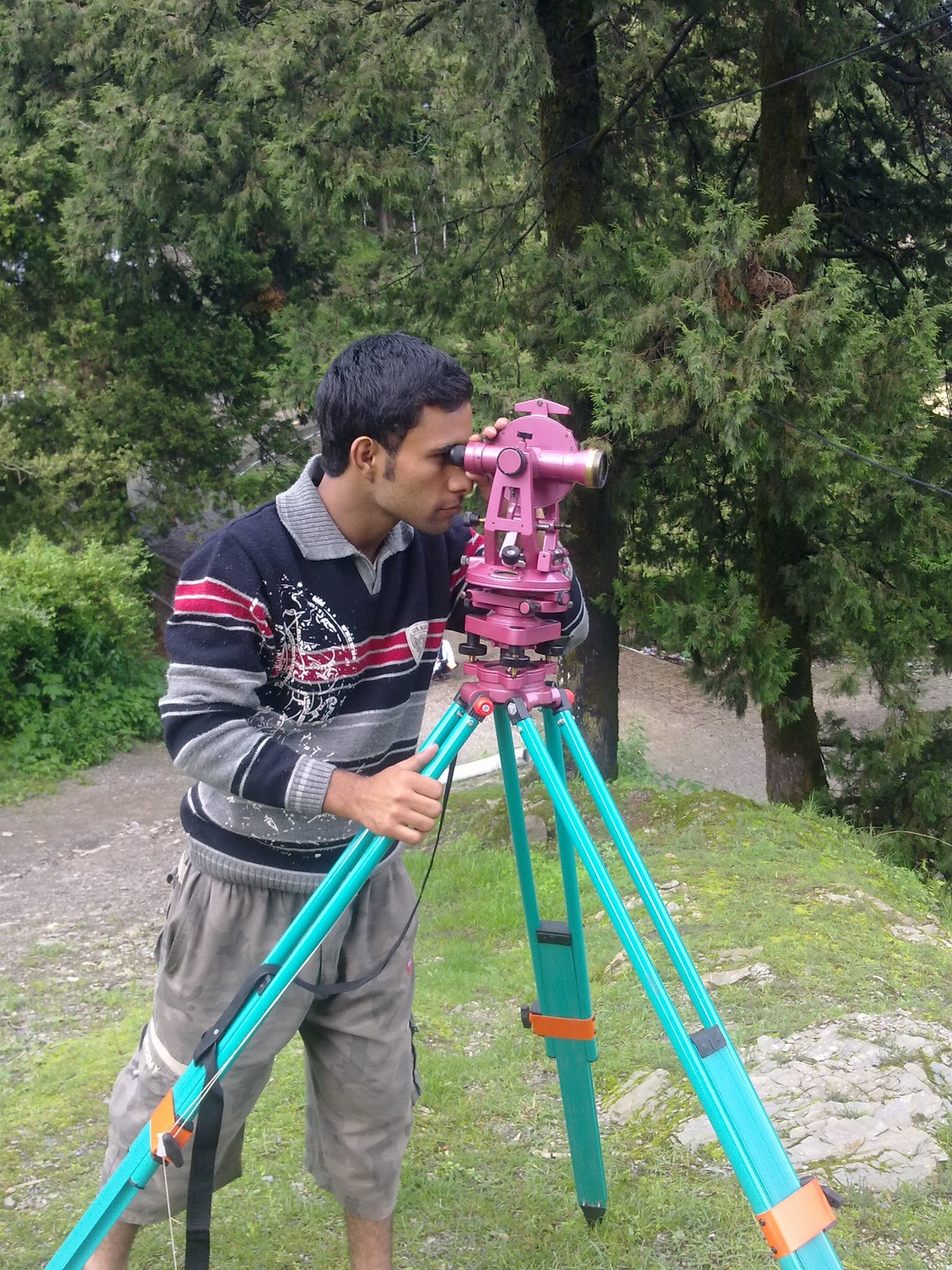
A theodolite   is a precision instrument for measuring angles   in the horizontal and vertical planes. Theodolites are mainly used for  surveying  applications, and have been adapted for specialized purposes in fields like metrology . A modern theodolite consists of a movable telescope mounted within two perpendicular axes — the horizontal  or trunnion  axis , and the vertical axis. When the telescope is pointed at a target object, the angle of each of these axes can be measured with great precision, typically to seconds of arc.

work of a surveyor.............

work of  a surveyor consists of following three sections........ 1.field work. 2.office-work. 3.care and adjustment of instruments. 1.field-work:- this includes taking measurements for details, recording field-notes and setting of work. 2.office work:-it consists of preparing maps,plans and sections from the  data collected  in the field and also calculating areas and volumes and designing various structures. 3.care and adjustment of instrument:- a surveyor must be thoroughly  familiar with the instrument.He must knows the appropriate method of using instrument because even a minor injury to instrument is liable to make them out of order.

History of surveying..............

Surveying techniques have existed throughout much of recorded history. Under the Romans, land surveyors were established as a profession, and they established the basic measurements under which the Roman Empire was divided,  such as a tax register of conquered lands (300 AD). In the 18th century in Europe triangulation was used to build a hierarchy of networks to allow point positioning within a country. Highest in the hierarchy were triangulation networks. These were densified into networks of traverses  (polygons), into which local mapping surveying measurements, usually with measuring tape, corner prism and the familiar red and white poles, are tied.

survey.........

测量 是 确定 物体 的相对位置 earth.Surveying 或 土地测量 表面 上 的 艺术 ,是 技术, 专业和 科学 准确地确定 点 和 them.Surveying 之间 的距离和 角度 的 地面 或 三维位置 一直 以来 有记载的历史 ( 5000年前 ) 开始 在 人类生存环境的 的 发展 的 基本要素 。 这是 需要 在规划 和 执行 几乎所有的 建筑形式 的 ..

types of survey

there are two main types of survey. 1.plane survey. 2.Geodetic survey. Plane survey:-I n plane survey the surface of earth assume as plane or straight its uses as limited distance. Geodetic survey:- in geodetic survey surface of earth assume as curve its use in long distance.

survey.........

Image
surveying  is the art of determining the relative positions of objects on the surface of earth. Surveying  or land surveying is the technique, profession and science of accurately determining the terrestrial or three-dimensional position of points and the distances and angles between them. Surveying has been an essential element in the development of the human environment since the beginning of recorded history (about 5,000 years ago). It is required in the planning and execution of nearly every form of construction..